As the global transition toward renewable energy accelerates, wind power continues to play a central role in achieving decarbonization goals. At the heart of efficient wind energy development lies accurate wind resource evaluation—an area where Wind Light Detection and Ranging (LiDAR) technology is redefining industry standards. The Wind LiDAR market is gaining strong momentum as developers, utilities, and researchers seek more precise, flexible, and cost-effective methods to measure wind behavior across diverse terrains and conditions.
The Evolution of Wind Resource Measurement
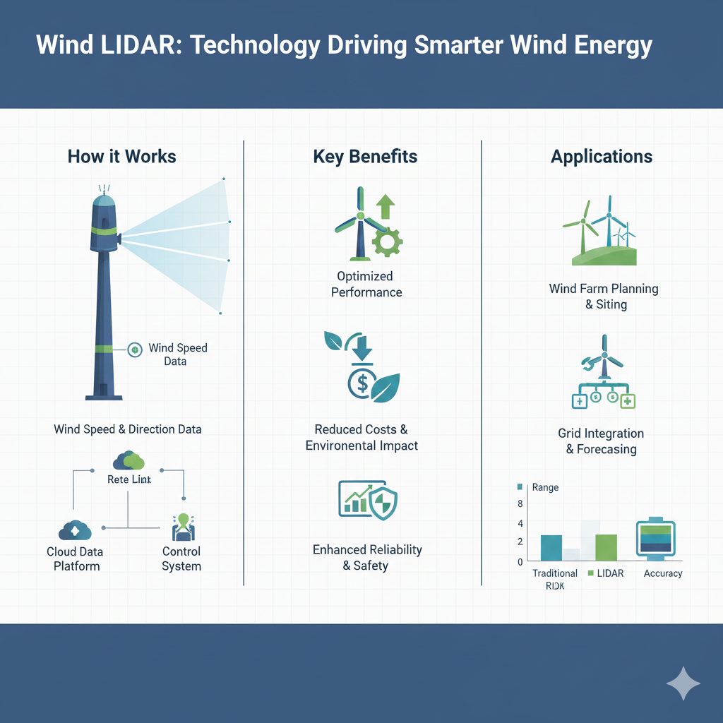
Traditional wind measurement techniques, such as meteorological (met) masts equipped with anemometers, have long been the industry benchmark. While effective, these systems come with limitations including high installation costs, physical height constraints, long permitting timelines, and reduced adaptability to complex or offshore environments. Wind LiDAR addresses these challenges by using laser-based remote sensing to measure wind speed, direction, shear, and turbulence at multiple heights—without the need for tall physical structures.
This shift from fixed-point measurement to remote, multi-dimensional data collection is transforming how wind resources are assessed during project planning, construction, and operation.
Why Wind LiDAR Is Gaining Traction
Wind LiDAR systems offer a combination of precision, flexibility, and operational efficiency. Ground-based LiDAR units can be rapidly deployed and relocated, making them ideal for early-stage site assessments and temporary measurement campaigns. Floating and nacelle-mounted LiDAR systems extend these advantages offshore and into operational wind farms, enabling continuous performance monitoring and optimization.
Key advantages driving market adoption include:
-
Multi-height wind profiling beyond traditional mast limitations
-
Reduced capital and installation costs compared to met masts
-
Faster deployment and permitting timelines
-
Enhanced suitability for offshore and complex terrain projects
As wind projects move into deeper waters and more challenging landscapes, these benefits are becoming increasingly critical.
Download PDF Brochure @ https://www.marketsandmarkets.com/pdfdownloadNew.asp?id=1261
Expanding Applications Across the Wind Energy Lifecycle
The role of Wind LiDAR now spans the entire wind project lifecycle. During the development phase, LiDAR improves the accuracy of wind resource assessments, reducing uncertainty in energy yield predictions and strengthening project bankability. In the construction phase, it supports validation of wind models and turbine suitability. During operations, nacelle-mounted LiDAR enables real-time wind measurements that improve yaw alignment, power curve verification, and overall turbine performance.
Beyond power generation, Wind LiDAR is also being used for wind forecasting, atmospheric research, and grid integration studies, broadening its relevance beyond traditional wind farm applications.
Technology Advancements Shaping the Market
Ongoing innovation is pushing Wind LiDAR technology to new levels of performance and reliability. Improvements in laser stability, signal processing, and data analytics are enhancing measurement accuracy even in harsh weather conditions. Integration with digital platforms, cloud-based data management, and advanced modeling tools is further increasing the value of LiDAR-generated insights.
Additionally, the combination of Wind LiDAR with AI-driven analytics is opening new possibilities for predictive maintenance, site optimization, and long-term performance forecasting.
Regional Momentum and Market Outlook
The Wind LiDAR market is experiencing strong growth across regions with ambitious renewable energy targets. Europe remains a leader, driven by offshore wind expansion and mature regulatory frameworks. North America continues to adopt LiDAR for both onshore and offshore projects, while Asia-Pacific is emerging as a high-growth region due to large-scale wind installations and increasing investment in clean energy infrastructure.
As governments and energy developers prioritize efficiency, reliability, and risk reduction, Wind LiDAR is increasingly viewed not as an optional tool but as a strategic asset.
Looking Ahead
The future of wind energy depends on smarter, data-driven decisions—and Wind LiDAR is central to that evolution. By delivering accurate, flexible, and scalable wind measurements, LiDAR technology is advancing wind resource evaluation and helping the industry unlock higher performance and lower project risk.
As the market matures, continued innovation and broader adoption will further cement Wind LiDAR’s role in shaping the next generation of wind energy development. In a world focused on sustainable power, measuring the wind with greater intelligence is proving to be a powerful advantage.
Wind LiDAR Market – Investor FAQ
1. What is Wind LiDAR and why is it important?
Wind LiDAR (Light Detection and Ranging) is a remote sensing technology that uses laser signals to measure wind speed, direction, shear, and turbulence at multiple heights. It is critical for accurate wind resource evaluation, which directly impacts wind project feasibility, energy yield forecasting, and investment risk reduction.
2. What is driving growth in the Wind LiDAR market?
Key growth drivers include:
-
Rapid expansion of onshore and offshore wind energy projects
-
Rising demand for accurate wind data to improve project bankability
-
Limitations and high costs of traditional meteorological masts
-
Growth in offshore wind, where fixed measurement infrastructure is challenging
-
Increased focus on performance optimization of operational wind farms
3. How does Wind LiDAR reduce investment risk in wind projects?
Wind LiDAR improves data accuracy and reduces uncertainty in wind assessments. Better wind data leads to more reliable energy yield estimates, improved financing terms, and lower chances of underperformance—making projects more attractive to lenders and investors.
4. Which segments of Wind LiDAR offer the strongest investment potential?
High-potential segments include:
-
Offshore and floating LiDAR systems due to offshore wind growth
-
Nacelle-mounted LiDAR for operational optimization and performance monitoring
-
Data analytics and software integration services built around LiDAR data
-
Rental and LiDAR-as-a-service models, offering recurring revenue streams
5. What are the main applications of Wind LiDAR?
Wind LiDAR is used across the wind energy lifecycle:
-
Pre-construction wind resource assessment
-
Power curve validation and turbine performance monitoring
-
Yaw optimization and wake analysis
-
Wind forecasting and atmospheric research